Tomb of Ramesses IV The pharaoh Ramesses IV was buried in Tomb KV2, located in the Valley of the Kings, Egypt. The tombs of Ramesses II and VII are on either side. Ramesses died at the age of 27 in 1148 BC. He is connected to the Temple of Khonsu at Karnak. Coordinates 25.741530,32.602080 Description The tomb is of similar design to others in that it has a corridor to the burial chamber with side rooms. It is thought to be about 75 metres long and declines about 10 metres from the entrance. Chamber E, as the antechamber, has stars painted on the ceiling. Chamber K is built with side rooms, and the burial chamber J has a vaulted ceiling with astrological patterns along with the sarcophagus. Coptic monks were said to have lived in the tomb, and in the 19th century, explorers like Jean-François Champollion had camped there. Earlier, Romans were said to have left what is considered as graffiti in the tomb. Measurements These are the tombs' measurements in metres, including the a...
Obliquity
 Is the separation angle of Khufu's and Khafre's pyramids an obliquity alignment, and why did they align forward of a forward date that was past the maximum tilt?
It is important that the 3 ÷ 60 angle is equal to a date that is 32.25 years, and this could then align so that it is at peak precession in the 1980s. However, this number does not connect at either peak or with a 32.25-year offset to any numbers used for precession.
The answer is that they wanted to incorporate the royal cubit, a length of 0.523 metres or 1 ÷ 1.9121, and associate it with peak precession. This is not an easy task to accomplish, and they may have found the answer while building the Meidum pyramid, as it contains numbers associated with precession.
(29.3599²×2046.2)÷922704=2013.95 2013.95−20−7=1986.95
2013.95−20−9=1984.95
The larger triangle in kilometres as 65.72×922.704.
If an angle of 3.989° is used for the larger triangle (instead of 4.07°), the distance is reduced to 64.197 kilometers.
64.197−65.72=1.523
The angle is precisely 239.345 seconds using a circumference of 40075 km and a 24-hour day with 60 minutes. This could show that the purpose of 65.72 km was a baseline to subtract the exact number. This number is then 239.345 s/° (about 4 minutes/°, in minutes) (239.345 ÷ 60 = 3.989).
They built around other pyramids after the Meidum pyramid, then decided to build on a plateau. The Meidum pyramid would be their stepping stone, increasing its importance for future and past pyramids.

It is important that the 3 ÷ 60 angle is equal to a date that is 32.25 years, and this could then align so that it is at peak precession in the 1980s. However, this number does not connect at either peak or with a 32.25-year offset to any numbers used for precession.
The answer is that they wanted to incorporate the royal cubit, a length of 0.523 metres or 1 ÷ 1.9121, and associate it with peak precession. This is not an easy task to accomplish, and they may have found the answer while building the Meidum pyramid, as it contains numbers associated with precession.
(29.3599²×2046.2)÷922704=2013.95 2013.95−20−7=1986.95
2013.95−20−9=1984.95
Analysis
They achieved this with the use of the Medium pyramid distance and a small golden ratio to produce a triangle.
2.23° to medium pyramid (√5) at 65.72km, 2.56km at 45° with 3.62km hypotenuse and 3.28 km² area.
They achieved this with the use of the Medium pyramid distance and a small golden ratio to produce a triangle.
2.23° to medium pyramid (√5) at 65.72km, 2.56km at 45° with 3.62km hypotenuse and 3.28 km² area.
The larger triangle in kilometres as 65.72×922.704.
As a triangle, it equals an angle of 4.07°, with an area of 30.3 km².
Also, the latitude °/km length equals 1 ÷ 1.618, and the 2 could equate with a 45° triangle of two equal sides.
0.59+0.029=0.618
65.72km+2.56km
Also, the latitude °/km length equals 1 ÷ 1.618, and the 2 could equate with a 45° triangle of two equal sides.
0.59+0.029=0.618
65.72km+2.56km
If an angle of 3.989° is used for the larger triangle (instead of 4.07°), the distance is reduced to 64.197 kilometers.
64.197−65.72=1.523
The angle is precisely 239.345 seconds using a circumference of 40075 km and a 24-hour day with 60 minutes. This could show that the purpose of 65.72 km was a baseline to subtract the exact number. This number is then 239.345 s/° (about 4 minutes/°, in minutes) (239.345 ÷ 60 = 3.989).
This is then one planetary rotation away from peak precession, connected by a gnomon measurement of 29 years using a 2.4° obliquity offset of 0.000117°/year.
Maximum Peak
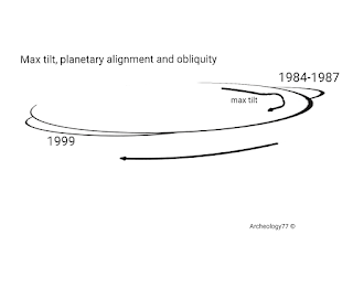
This is open to speculation as to whether they were guessing or hedging their bets so as to peak in 1984 or 2013. They chose 2013, but their peak was in July (July 1986) and continues to reduce the ability to be helped by obliquity. This is also open to speculation because the Jupiter and Saturn alignment and peak actually occurred in August 1985, which does not have to align.
Maximum Peak
This is open to speculation as to whether they were guessing or hedging their bets so as to peak in 1984 or 2013. They chose 2013, but their peak was in July (July 1986) and continues to reduce the ability to be helped by obliquity. This is also open to speculation because the Jupiter and Saturn alignment and peak actually occurred in August 1985, which does not have to align.
This is due to the planet's tilt and inclination to the sun, which has different effects at different times. Both occurrences cause the maximum tilt to be unclear, and only another planetary alignment would clarify the situation. Along with this, there was an alignment of other large planets: Jupiter and Saturn align every 20 years or so, and the others align less frequently.
Planetary Gravitation
The effect of planetary gravitation is greater than tilt but is brief and has a peak effect, so when both occur, the effect is blurred. (0.000117°×29)=0.003393°
(0.00155°×29)=0.04495°
Planetary Gravitation
The effect of planetary gravitation is greater than tilt but is brief and has a peak effect, so when both occur, the effect is blurred. (0.000117°×29)=0.003393°
(0.00155°×29)=0.04495°
They built around other pyramids after the Meidum pyramid, then decided to build on a plateau. The Meidum pyramid would be their stepping stone, increasing its importance for future and past pyramids.
Jupiter and Saturn aligned together in 1981, 2000, and again in 2020, but the peak occurred when all the large planets were aligned in the shape of a triangle.
Conclusion
Marker points for these triangles no longer exist. Their purpose would include at least two links from the Medium pyramid to the Giza pyramids. This was for the purpose of allowing two links at other points in the build while including both possibilities.
It isn't clear, but it can be shown that they made a link to 2046 ad so as to include maximum tilt or peak within those years.
Comments
Post a Comment